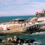
Kottayam located on the basin of the Meenachil River and the Vembanad backwaters is a city in Kottayam District of Kerala India. It is located about 150 km from the state capital Thiruvananthapuram. It is an important trading center of spices and commercial crops, especially rubber. Alappuzha district, Ernakulam district and Pathanamthitta district surrounds the city.
Kottayam on Google Map
How To Reach Kottayam
By Air– Kochi International Airport is located about 93 km is the nearest airport from the Kottayam City. The airport have flights from all the major cities of India. Thiruvananthapuram Airport is also there located about 152 km from the city. From both cities there are railways and road services and can be easily accessed.
By Train– Railway line of Kottayam is very well connected to all the major cities of India and Kerala Also. Kottayam can be easily accessed by any part of India easily.
By Road– Kottayam is easily accessible by all the cities of Kerala. There are many bus services from Chennai, Bangalore, Mangalore, Coimbatore to Kottayam.
By Boat– Ferries services are very frequent from Alappuzha to the Kottayam city. It is cheapest mode of transportation in the state.
Distance Chart to Kottayam
| City | Distance |
|---|---|
| Cochin | 63 km |
| Kollam | 96 Km |
| Thiruvananthapuram | 154 Km |
| Chennai | 671 Km |
| Madurai | 247 Km |
| Kozhikode | 257 Km |
| Coimbatore | 246 Km |
| Bangalore | 589 km |
| Mangalore | 492 Km |
| Goa | 842 Km |
| Munnar | 139 Km |


Add How to Reach Kottayam Feedback, Comments, Reviews