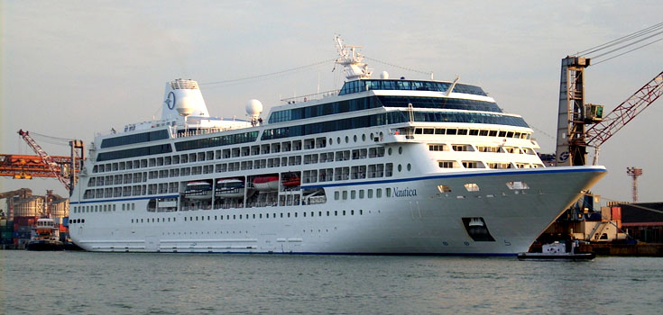
Cochin Port is one of the largest and major port on the Arabian Sea–Indian Ocean sea-route in India. The port is located on two islands in the Lake of Kochi: Willingdon Island and Vallarpadam, towards the Fort Kochi river mouth opening onto the Arabian Sea. The International Container Transshipment Terminal (ICTT), part of the Cochin Port, is the largest container transshipment facility in India.
Historical Facts
The Cochin port was formed naturally due to the great floods of Periyar in 1341 AD, which choked the Muziris port , one of the greatest ports in ancient world. SInce Then Cohin Port become world famous and had extensive trading relations Romans, Greeks and Arabs, all lured by the traditional spice wealth of the state. The port further attracted European colonialists like Portuguese, Dutch and finally British who extended their supremacy over the Kingdom of Cochin and the port city of Fort Kochi.
Cochin Port Government Organization
The port is governed by the Cochin Port Trust (CPT), a government of India establishment. The modern port was established in 1926 and has completed 86 years of active service. The International Container Transshipment Terminal (ICTT), part of the Cochin Port, is the largest container transshipment facility in India.Cochin Port Trust is an autonomous body under the government of India and is managed by Board of Trustees constituted by the government. The board is headed by the chairman who acts as the chief executive officer.

By- Adarsh K (Flickr)
Facilities at Cochin Port
The entrance to the Port of Cochin is through the Cochin Gut between the peninsular headland Vypeen and Fort Cochin. The port limits extend up to the entire backwaters and the connecting creeks and channels. The approach channel to the Cochin Gut is about 1000 metre long with a designed width of 200 meters and maintained dredged depth of 13.8 meters .Berthing facilities for ships have been provided in the form of wharves, berths, jetties and stream moorings alongside these channels.
Berth Information– The main inward shipping channel of the port divides in to the Ernakulam and Mattancherry channels .The Ernakulum Channel is 4.90 Km long, with the width varying from 250 to 500 m and has a draft of 12.5 m up to the Oil Terminal and Q8 / Q9 and a draft of 9.14 m up to the wharves and the north and south tanker berths.. The 1024 m long Ernakulam Wharf has six alongside berths, five for general cargo and a fertilizer berth. Besides there are three oil berths in the Ernakulum channel. The Mattancherry channel is 4.08 Km long, with the width varying from 180 to 250 m and a draft of 9.14 m except at Boat Train Pier where the draft is 10.0 m. On the Mattancherry Channel there are four alongside berths, for general cargo, one Boat Train Pier and two jetties for miscellaneous cargo.
Cargo Storage Facility
| COVERED AREA (Transit Sheds and Overflow sheds) | ||
|---|---|---|
| Location | Total Sheds | Area (Sq.m) |
| Mattanchery Wharf | 6 | 19160 |
| Ernakulam Wharf | 5 | 13200 |
| Container Freight Station | 1 | 10000 |
| Grand Total | 12 | 42360 |
| COVERED AREA (Warehouses) | ||
|---|---|---|
| Location | Total Sheds | Area (Sq.m) |
| Mattanchery Wharf | 4 | 11800 |
| Ernakulam Wharf | 1 | 2980 |
| Cement Godown | 1 | 1000 |
| BTP | 1 | 6000 |
| Grand Total | 7 | 21780 |
Single Point Mooring for Crude Oil Import– Kochi Refineries Ltd has set up a Single Point Mooring System (SPM) as captive reception for the import of Crude oil. The facility is capable of receiving Very large Crude Carriers (VLCCs) of 300,000 DWT. The SPM is connected by a pipeline of 19.5 km to tank storage facilities at Puthuvypeen. The SPM is located at a water depth of 30 m, about 19 km from the coastline of Puthuvypeen. The SPM is connected to the shore by a 48 inch pipeline that runs to a storage facility comprising 4 tanks of 80,000 Kl each. The total area of the facility is 70 hectares, which provides room for two more storage tanks of 80,000 Kl capacity.
Cochin Port Trust Official Website– http://www.cochinport.com/


Add Cochin Port Feedback, Comments, Reviews