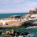
Alappuzha Location
Alappuzha is a city in the Alappuzha District of Kerala India. Alleppey is the sixth largest city if Kerala. The city is located in the plain areas with no hills surrounding it. Alleppey is situated 62 kilometers (39 mi) to the south of Kochi and 155 kilometers (96 mi) north of Trivandrum.
How To reach Alappuzha
By Air – Cochin International Airport is the nearest airport from Alappuzha. From there taxi can be hired to reach Cochin and to reach Alappuzha one can take bus , or train. One can reach to other cities also and from there train to Alappuzha.
By Train– Alappuzha is well connected by rail network. One can reach here from many cities like Cochin, Thiruvananthapuram, Kozhikode, Chennai, Bangalore, Coimbatore, Mumbai Bombay, New Delhi, Mangalore, and Kolkata.
By Road– Alappuzha district is well-connected by National Highway 47. Kochi, Kottayam, Kollam, Thiruvananthapuram , Kozhikode, Chennai, Bangalore, Coimbatore are well connected by road to Alappuzha. There are bus services from these cities also. Luxury buses, common buses , one can also hire taxis to this city.
Alappuzha In Google Map
Alappuzha Distance Chart
| City | Distance |
|---|---|
| Kottayam | 53 Km |
| Kollam | 100 Km |
| Munnar | 172 Km |
| Madurai | 277 Km |
| Bangalore | 578 Km |
| Chennai | 729 Km |
| Coimbatore | 236 Km |
| Kozhikode | 246 Km |
| Cochin | 53 Km |
| Thiruvananthapuram | 160 Km |
| Mysore | 393 Km |


Add How To Reach Alappuzha Feedback, Comments, Reviews