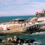
Location of Thiruvananthapuram
Thiruvananthapuram the capital of state Kerala is located at the west coast southern tip of the India. It is the largest city of Kerala. Thiruvananthapuram is based on seven hills and bounded by Arabian Sea to its west and the Western Ghats to its east. It is a fascinating destination for tourist in Kerala.
Thiruvananthapuram On Google Map
How to reach Thiruvananthapuram
By Air– Trivandrum International Airport is located in the city and is connected by all the major cities of India. There are regular Domestic flights to the city.
By Train– One of the major Indian railway station Trivandrum Central railway station is located at Thampanoor in the city and is well connected and serviced by rail to all major cities in India. The city can be easily accessed by all the parts of India.
By Road– Trivandrum has a good connection with road also it can be reached by various cities of India easily and is very well connected by the cities of the state Kerala. Many bus services are there to reach the city from Bangalore , Rajasthan, Chennai Cochin Mysore Mumbai and Coimbatore and many more.
Thiruvananthapuram Distance Chart
| City | Distance |
|---|---|
| Kollam | 70 Km |
| Kottayam | 153 Km |
| Cochin | 205 Km |
| Madurai | 309 Km |
| Chennai | 764 Km |
| Coimbatore | 387 Km |
| Kozhikode | 398 Km |
| Mysore | 545 Km |
| Bangalore | 712 Km |
| Mangalore | 633 Km |
| Thrissur | 280 Km |


Add How To Reach Thiruvananthapuram Feedback, Comments, Reviews