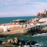
Kasargod is a city in Kasargod District of Kerala India. It is the northernmost district of Kerala. The district has a coastline of around 293 kilometers and is popular with the forts, rivers, hillocks, beaches and shrines.Kasaragod town lies on the path of NH 17. It is well connected by road to Kannur, Mangalore, Kozhikode, Kochi and Thiruvananthapuram.
How to Reach Kasaragod
By Air: You can reach the city By Air where the nearest airport from Kasaragod is at Mangalore, which is about 50 km away while the Kochi Airport is 420 km south.
By Rail: You can reach the city by rail as the city has a Railway station, which is linked to several important towns in the state as well as other parts of the country.
By Road: You can reach the city by road as the city is well connected to other towns of the state as well as India by Motorable roads. Buses, operated by private as well as state operators are available in different cities and towns.
Travel Information On Traveling Inside Kasaragod
You can travel within the city by Bus, Autorickshaws, Taxis and Cars as there are many rental companies offering cars with drivers or self drive/ Alternatively you can even walk as many places of attractions are nearby other so you could walk between them Many places like Bekal, Kottappuram, Valiyaparamba provide House Boats where you can enjoy a memorable and wonderful cruise in the backwaters.
Kasaragod On Goolge Map
Kasaragod Distance Chart
| City | Distace |
|---|---|
| Mangalore | 56 Km |
| Bangalore | 382 Km |
| Mysore | 228 Km |
| Chennai | 697 Km |
| Coimbatore | 367 Km |
| Kozhikode | 181 Km |
| Cochin | 382 Km |
| Kottayam | 429 Km |
| Thiruvanathapuram | 583 Km |
| Palakkad | 316 Km |
| Madurai | 550 Km |
| Kannur | 91 Km |
| Thrissur | 300 Km |


Add How to Reach Kasaragod Feedback, Comments, Reviews